Cambridge Railway Line, Station, and it's affect on the Kingston Street Area.
Although not part of Kingston Street, the railway from London to/through Cambridge made a significant impact on the area and prompted the building of Kingston Street as it is today. Kingston street is a collection of railway cottages. Therefore a brief history of the railway and it's affect on the street is included...
Nsi1qhkBMh+m+T4fQ~~_12.jpg)
Cambridge Station, A Tribute.
Source unknown.
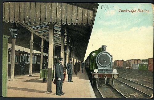
Cambridge Railway Station Post Card
Date written on front 13.09.05
Source unknown.
The railway from London to Cambridge made a significant impact on the Kingston Street area. The railway made the area a target for criminality, the poor.. in short it became a slum. But the area managed to improve.
The following two excerpts prove interesting reading:
1. Barnwell
"By the mid-19th century, Barnwell [Kingston Street & environs] was a rough area inhabited predominantly by railway workers and manual labourers such as those mining fossil beds. Ion Keith-Falconer opened a mission in a local theatre in 1875 in an attempt to reduce poverty in the area. The astronomer William Scott also worked in the slums in the 1850s as a curate.
Barnwell Junction railway station opened in 1884 as the first station on the Cambridge to Mildenhall railway. It closed in 1962.[4]
Known as Bernewell in the 13th century, and before that Beornewelle, the name Barnwell means "well of Beorna", where Beorna is a name meaning "warrior". The common belief that it derives from bearn, an old word for a child, is incorrect.[5]"
From http://en.wikipedia.org/wiki/Barnwell,_Cambridgeshire
2. Brief History Of Kingston Street
"The coming of the railway in 1845 signalled the transformation of the whole area from quiet country to bustling town. On 19 December 1867, the Rev Richard John Geldart (?son of James) sold some of the land to Joseph Sturton, a wholesale chemist of Fitzroy Street.
The land was then parcelled up into plots. A builder would buy a plot of land, build a few houses on it and sell them. As you walk down Gwydir Street [and Kingston Street, etc], you can see different building styles every few houses. This gives the area its slightly crooked charm, as opposed to terraced housing in northern England, where the whole street was built at once by the same builder."
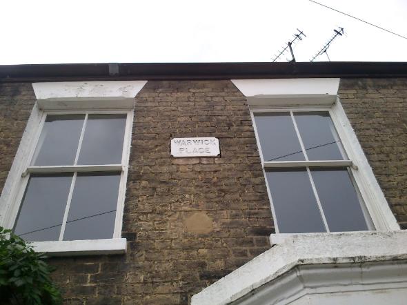
[An example of this can be seen in Warwick Place, midway down Kingston Street. It is a distinct block of buildings built by one landlord.]
"The houses were sold to landlords, who rented them out. The unplanned and virtually overnight erection of countless dwellings brought with it many disadvantages. Overcrowding and primitive water supply and sewage disposal led to the spread of disease. A typhoid epidemic of 1888 was traced back to an inhabitant of Sturton Street and the area was a haven for villians. The degenerate nature of the area at that time resulted in a host of voluntary agencies being set up, ranging from the Co-Operatives to Temperance Societies. The appropriate authorities also decided that the Church of St. Andrew the Less was too distant and too small to provide the necessary Christian influence in the area. Accordingly, St. Matthews Church was built in 1866 and St. Barnabas Church on Mill Road in 1880.
Educational facilities were provided by the Old School Trust and the church. From 1870 onward, a variety of Sunday Schools and day schools in Norfolk Street, Sturton Street and York Street catered for the needs of children of all ages in the community. The primary source of education for adults of the area was the Mill Road Free Library which was opened in 1897, its previous site having been on East Road. Today most of the schools and library no longer exist or are used for some other purpose, but we still have Brunswick Nursery, St. Matthews Primary School and Anglia Ruskin Unversity, serving not only this area, but far beyond.
The population of West Barnwell (as our area was called) in 1871 was 6,585. Those who lived in the area were, on the whole, employed in unskilled or labouring work for the colleges, railway or building trade. Girls usually went into service. Many were unable to find work at all. A limited survey of 1906 suggested that unemployment in St. Matthews area accounted for 20% of the figure for the whole of Cambridge.
By the late 1880s the transformation from open field to town was virtually complete, in that the majority of the area was built up and densely populated. As the area developed, so did the facilities, an adequate system of water supply and main drainage coming into existance at the start of the twentieth century.
The population fell throughout the twentieth century. In 1911 it was 5,732 and by 1961 it had fallen to 4,165. In the mid twentieth century, the area was considered for 'slum clearance', for redevelopment and road plans. This never happened. In 1976 the GIA ( General Improvement Area) was launched, giving grants to people to improve their houses."
From Jo Edkins' Website about Gwdir Street - www.colc.co.uk/cambridge/gwydir